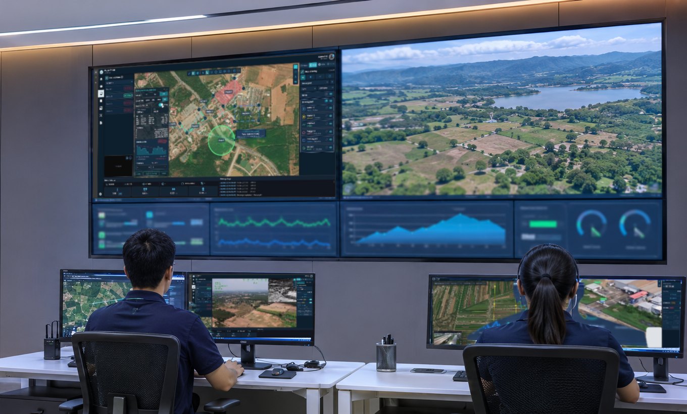
One system, from aircraft to command centre

The aircraft is half the system. The other half is mission planning, datalink and command software, and ICS builds all of it.

  1. UAV fleeteVTOL / multirotor with RGB, LiDAR, EO/IR
  2. DatalinkAES-256, MIMO, mesh
    Direct 10–50 km, further with a Repeater Unit
  3. FlightLyncmission planning, pre-flight, telemetry
  4. UXV C2multi-aircraft streams, permissions, flight logs
  5. Data & AI outputorthomosaic, DSM/DTM, point cloud, AI detection

FlightLync (Ground Control Software)

Plan, pre-check and monitor every flight in one program

Windows ground control station for automated flight planning and control, with pre-flight checklists and performance-limit alerts, survey and corridor missions, and real-time monitoring with live video.

  • Survey and corridor planning with auto overlap
  • Import your own Ortho and DEM, works offline
  • GIS tools: measure distance and area, draw polygons
  • Terrain following for even overlap over hills
  • ADS-B and no-fly-zone import
  • Pre-flight check: sensors, motors, servos, battery
  • Live telemetry and video, geotagged log
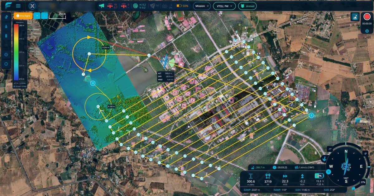
FlightLync: Survey flight lines with automatic overlap

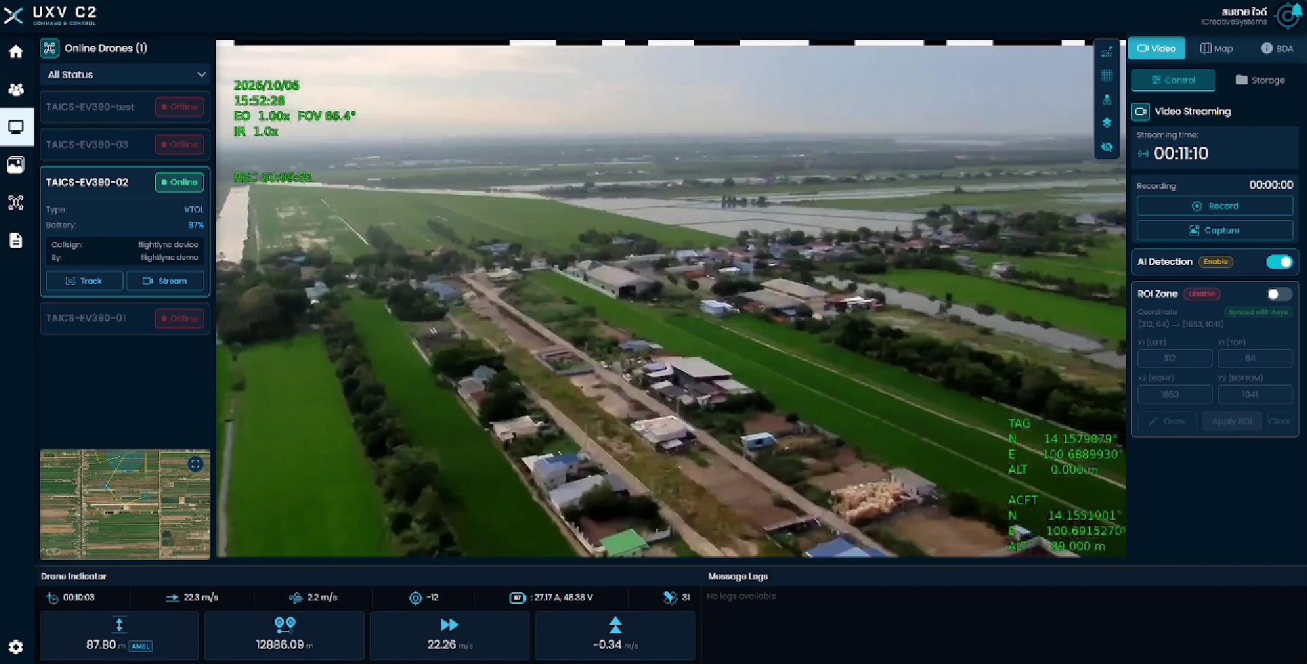
UXV C2

Every aircraft, every camera, one command centre

Command-and-control platform that brings live video and status from multiple aircraft into one command centre. Runs in the cloud or on‑premise for enterprise use.

  • Live multi-camera EO/IR, record and capture
  • AI object detection in your ROI zones
  • Shared map: measure distance and area, draw polygons
  • Import your own Ortho and DEM, works offline
  • Photo and video library to review anytime
  • PDF or KMZ reports with coordinates
  • 3D flight replay
UXV C2: Live multi-camera view with thermal and flight data
Real FlightLync screen during the actuator check

Checked before every flight

FlightLync walks the operator through each step before take-off. It spins each motor in turn and moves every control surface, then records pass or fail. The aircraft is not ready until every item passes.

  1. Environment
  2. General
  3. Payload
  4. Motors and servos
  5. Airspeed sensor
  6. Mission check
  7. Final check
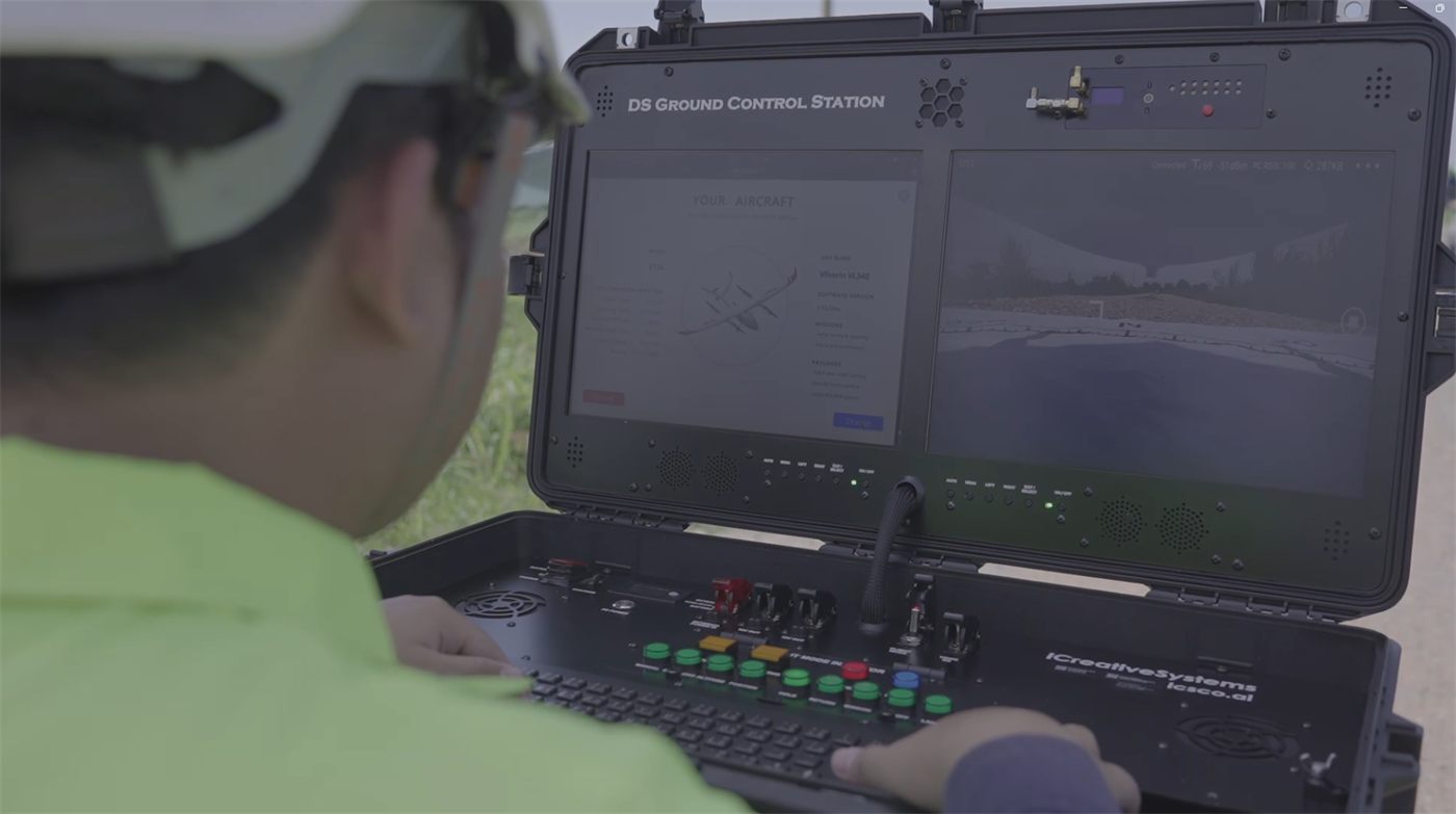
DS Ground Control Station

DS Ground Control Station

Field ground-control hardware: rugged and quick to deploy. ICS builds both the station and the FlightLync software it runs.

  • Built for use in outdoor light
  • Runs for more than 4 hours continuously
  • Two screens: easy to run FlightLync and the EO/IR camera together
  • Connects to an external display over HDMI
  • Good cooling system

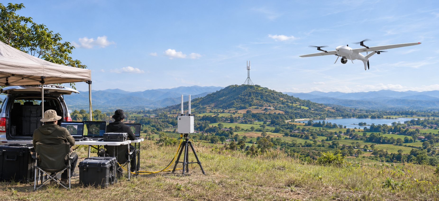
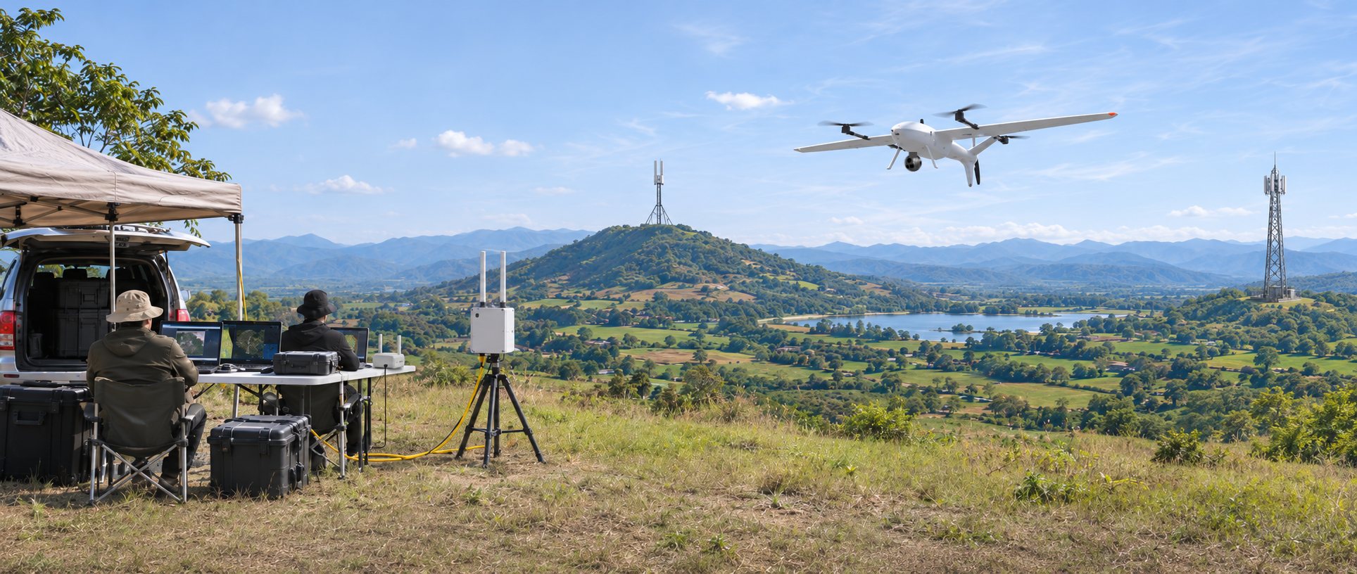
Extended range with mesh datalink

Direct ground-to-air link up to 10–50 km. Beyond that, a Repeater Unit on high ground extends it.

Field ground station on a hillside, wired to a DL Ground Unit, relaying through a hilltop repeater to a Vertix VL260

Ground Control Station

DL Ground Unit

DL Repeater Unit

Vertix VL260

  1. Ground Control StationPlan, watch live video, command
  2. DL Ground UnitWired to the GCS, portable
  3. DL Repeater UnitOn high ground, extends the range
  4. Vertix VL260Sends video and telemetry, takes commands
Ground LAN cableWireless mesh datalink via the repeaterDirect aircraft–DL Ground Unit link, 10–⁠50 km
  1. Ground Control Stationmission planning, live video & telemetry, command & control, recording
  2. DL Ground Unitconnects to GCS over LAN, portable
  3. DL Repeater Unitinstalled on high ground to extend range
  4. UAV with DL Air Unitreal-time video, telemetry, command & control, optional GNSS